|
|
MODELLING LAND USE DYNAMICS IN THE SPANISH NETWORK OF NATIONAL PARKS AND THEIR HINTERLAND (DUSPANAC) |
|
|
Maps Thsi page gives access to the cartographic database of the project, where the maps and GIS layers of the DUSPANAC project can be found. This information is represented through a web page containing specific information about each National Park (Duspamap), and two cartographic viewers: one dedicated to general information about all of the Spanish national parks and their immediate hinterland, and another focussed on the Doñana Natural Area in which the future land use scenarios generated by the Cellular Automata model are shown. 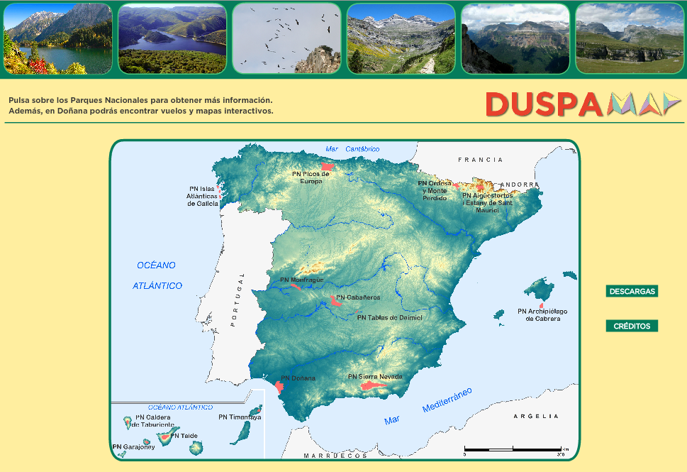
|
|
 |
 |
 |