
|
|
|||||
|
|
|
Buffering Polygon Data GIS operations often require a point, line or polygon to be 'buffered' for analysis purposes. The algorithm for buffering polygon data uses the same process as the line buffering algorithm, with one small difference - the polygon buffer is created on only one side of the line which defines the polygon. The default method is to create a buffer which surrounds the polygon boundary - some GIS software packages also give an option to create a buffer that lies inside the polygon boundary. Below is an example of the possible outputs of buffering a polygon. |
||
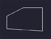 Original Polygon |
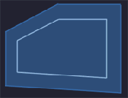 Outside Polygon Buffer (50 units) |
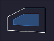 Inside Polygon Buffer (50 units) |
|
|
||