|
|
|||||
|
|
|||||
|
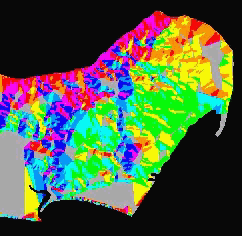
Aspect is calculated using the north-south and east-west gradients as expressed using the following equation: Aspect = ArcTangent (dEW/dNS) The above equation is adjusted to reflect aspect in degrees in a range from 0 to 360. Often -1 is used to represent a cell with no slope (skyward aspect) and the values from 0 to 360 represent azimuths in clockwise degrees from north. North is 0, East is 90 degrees, South is 180 degrees etc. Optionally, the result is then divided by 22.5 and converted to an integer to derive a set of generalized solar azimuths . (or see the ArcView
explanation)
|
|||||||||||||||||||||
| Click here to download all Theory presented in this Module | |||||||||||||||||||||
| references | |||||||||||||||||||||
|
|
|||||||||||||||||||||