|
|
|||||
|
|
|||||
|
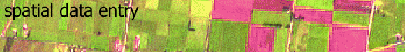
introduction The following
types of information can be gained from aerial photographs: Remote sensing includes all information collected from sensors which are physically separate from the object. In the context of this thesis, remote sensing is concerned with deriving information about the Earth's surface using an elevated platform, to produce such information as satellite data or aerial photography.
Remote sensing instruments rely upon the detection of energy emitted from, or reflected by, the object under consideration. Remote sensing allows the measurement and monitoring of surface electromagnetic variation, and as such this data provides a unique way of viewing the landscape. Satellite remote sensing is the only source of data with which we can view the entire planet and monitor the change in the nature of the surface of the planet through time, in a consistent, integrated, synoptic and numerical manner. Satellite remote sensing has the ability to provide complete, cost-effective, repetitive spatial and temporal data coverage, which means that various phenomena can be analysed synoptically, and such tasks as the assessment and monitoring of land condition can be carried out over large regions. As well as being of use by itself, remote sensing can be also be used as an important data source for the development and refinement of models, and can be used to validate models. When using satellite remote sensing, the relationship
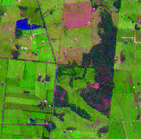
between spectral response and ground features is complicated by the
fact that individual image cells (pixels), which can range from 10
m to 1 km in size depending on the source of data used, are heterogeneous
and may contain a mixture of phenomena (see Figure
2 below). The individual spectral responses of features within
a cell are averaged to produce the value for the cell. Therefore,
methods of remote sensing will only be effective if the phenomena,
or classes of the phenomena, cover areas larger than a pixel.
Therefore the spectral data needs to be enhances, filtered or perhaps geometrically transformed with image processing techniques before it can incorporated into a GIS. An important problem is the rectification of the remotely sensed imagery with the grid which the GIS is using. Rectification is the process by which and image or grid is converted form image coordinated to real-world coordinates. Rectification typically involves rotation and scaling of grid cells and thus requires resampling of values. This is achieved by using resampling techniques which involve defining new pixel positions for the GIS map grid, and filling them with data determined by interpolation algorithms such as nearest neighbour, bilinear interpolation or cubic convolution (see the Raster Spatial Analysis Module for more information on spatial resampling).
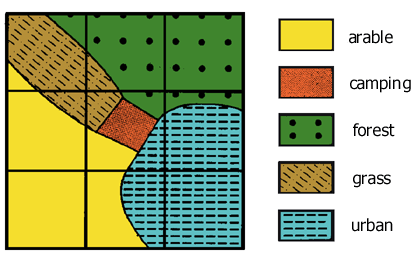
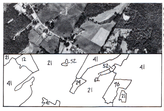
aerial photographs, air photo interpretation and digital photogrammetric mapping Aerial photographic interpretation has been the most widely used form of remote sensing for environmental applications to date, with techniques being well established. This wide use stems from the availability of aerial photographs, and the fact that they can provide very high spatial resolution data, down to metre accuracy, not historically available from other sensors. Qualitative analysis relies on image interpretation and is basically descriptive. Photo interpretation involves a human analyst viewing an image, and extracting information, and due to its use of the human mind, is unequalled in the possibilities of pattern recognition and spatial association. The success of this technique is highly dependent on the analyst effectively exploiting the spatial, spectral and temporal elements present in the image. Images, whether aerial photographs or satellite imagery, have a very high descriptive value due to the ability of the human interpreter to interpolate and find patterns. For both aerial photographs and space-borne remotely sensed data, the scale of the image will determine to a large extent the potential of the interpretation. Photo interpretation, whether of aerial photography
or of satellite remote sensing data, is prone to the problems of being
non-repeatable and not offering uniformity of analysis. It is highly
subjective and depends upon the interpreter's knowledge and understanding
of the spatial area under consideration and the process or phenomena
involved.
|
|||||||||||||||||||
|
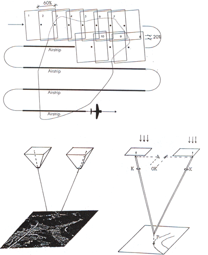
Digital photogrammetric mapping uses digital images of a pair of overlapping photographs and operators use special 3D glasses to digitise (x, y, z) coordinates of features.
|
|||||||||||||||||||
| Click here to download all theory presented in this module | |||||||||||||||||||
|
|
|||||||||||||||||||