|
|
MODELLING LAND USE DYNAMICS IN THE SPANISH NETWORK OF NATIONAL PARKS AND THEIR HINTERLAND (DUSPANAC) |
|
|
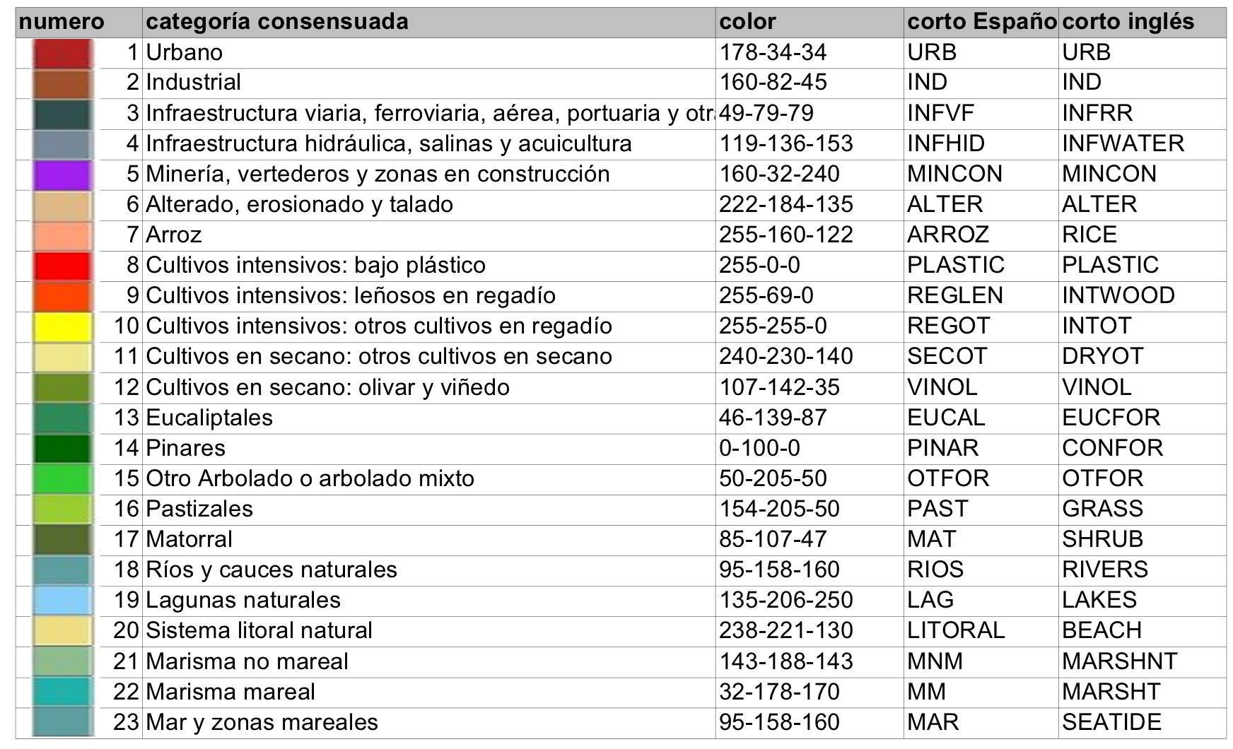
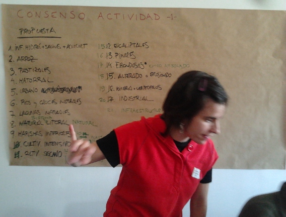
FIRST PARTICIPATORY WORKSHOP OF THE DUSPANAC PROJECT, FEBRUARY 22 2012 RESULTS OF ACTIVITY 1 - Grouping the land use categories The aim of this activity was to define the land use categories that were most relevant to explain the change dynamics encountered in Doñana and its area of influence. In this activity we used the database developed by the Government of Andalusia (Moreira 2007) at 1:25000 scale, on the basis of whichthe DUSPANAC research team had already reduced the 107 land use/land cover categories to 48. These 48 categories provided the starting point for the work carried out in this activity, which would provide the backbone of the land use model. However, it was necessary to reduce the number of categories still further, in order to represent the observed changes in as concise a manner as possible, and to establish groupings that reflected the reality as closely as possible. In order to achieve this it was necessary to incorporate local knowledge using participatory processes to establish the land use categories. For particpatory land use category development the particpants were divided into 3 groups of 4/5 people and a set of pre-printed cards representing the existing 48 land use categories was handed out to each group. Each group then carried out a discussion and category aggregation excercise, combining those categories that the group considered to represent the same dynamic. Subsequently, each group presented their categorization to all participants and an open discussion session was initiated in order to arrive at a single classification representing the consensus opinon of all particpants. The table below shows the 23 consensus categories that workshop participants considered the most appropriate for modelling Doñana and its area of influence:  The categorization developed by each group (left) Searching for common links between the three different classifications (below) |
Group discussion of the land use categories The process of aggregation and division of categories Presentation of the land use classification developed by each group 
The process of consensus Results of Activity 1 individual group land use categories , prior to process of consensus Master table of starting categories (Moreira 2007), preliminary grouping and final agreed classfication Final agreed particpatory classfication Land use maps prepared by the Government of Andalusia (Moreira), 1:25000 scale, reclassified according to the final agreed particpatory classification, 1956, 1999, 2003 y 2007 Open in a new window |
 |
 |
 |