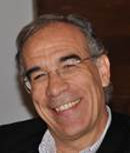
Research Lines:
Environmental Applications of Remote Sensing (Forest Fires, Global Change, Deforestation, Natural Disasters). Environmental ethics and religious attitudes towards environmental conservation.

F. Javier Salas Rey
Professor of Regional Geographic Analysis
Telf.: +34 91 885 5259
ORCID: 0000-0002-8208-6703
Research Lines:
GIS and Remote Sensing applied to forest fire risk, vegetation mapping, and change detection.
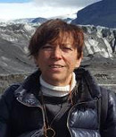
Inmaculada Aguado Suárez
Professor of Regional Geographic Analysis
Telf.: +34 91 885 5262
ORCID: 0000-0002-9975-849X
Research Lines:
Wildfire risk assessment and cartography. Relation between Forest Fire Severity and post-fire recovery. Forest Fires disturbance monitoring from Landsat time series.
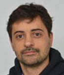
Research Lines:
Characterization of 3D forest structure and dynamics at different scales using active (LiDAR, SAR) and passive sensors; remote sensing applied to forest fires: estimation of forest full properties (moisture content and structure), fire damage assessment and post-fire vegetation recovery; integration of remotely sensed data using machine learning techniques; radiative transfer models; assessment of deforestation and forest degradation processes; forest health assessment.

Research Lines:
Global change effects on forests including underlying factors of demographic responses and multifuncionality; potential effects of climate change and extreme events; role of functional diversity and implications for forest management and restoration.
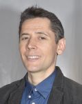
Mario Burgui Burgui
Assistant Professor. PhD in Land Use Planning and Environment. M.Sc. in Environment and Development. Degree in Environmental and Agricultural Biology.
Telf.: +34 918 856 384
ORCID: 0000-0002-4159-1324
Research Lines:
Tourism Geography. Landscape Geography. Carbon Footprint. Environmental Ethics.
Patricia Oliva Pavón
Beatriz Galindo Research Fellow. Ph.D. in Cartography, GIS and Remote Sensing. Degree in Environmental Sciences
Telf.: +34 91 885 5257
ORCID: 0000-0001-5051-3662
Research Lines:
Design of algorithms for burned area mapping; detection of hot spots in VIIRS images; estimation of emissions produced by forest fires; study of smoke plume dispersion; analysis of the effect of pollution produced by forest fires on public health.
Mª Lucrecia Pettinari
Associate researcher. PhD in Geographic Information Technologies. M.Sc. in Geographic Information Technologies. Environmental Engineer.
Telf.: +34 91 885 5257
ORCID: 0000-0002-7472-4373
Research Lines:
Global fuel mapping, wildfire risk assessment, fire behaviour, burned area detection at global and regional scale. Scientific Project Management.
Miguel Ángel Torres Vázquez
Postdoctoral Researcher - FireCCI Project. Ph.D. in Biodiversity and Environmental Management.
ORCID: 0000-0001-8897-9337
Research Lines:
My research focuses on the seasonal prediction of natural hazards, such as droughts and fires, through climate analysis, the evaluation of uncertainty in the data and the harmonization of spatio-temporal series, with the aim of anticipating these phenomena and reducing their impact on society.
Carlota Segura García
Post-doctoral research in the XFires Project. PhD in Environmental Sciences from the University of Oxford. MSc in Complex Systems Modelling from King’s College London. Undergraduate degree in Physics from the University of Barcelona.
Telf.: +34 91 885 5257
ORCID: 0009-0001-8749-8360
Research Lines:
Analysis of geospatial data to characterise the spatial and temporal patterns of fires, and understand how these are shaped by the climate and human activities. Currently, I am studying the occurrence of extreme fires at a global scale, aiming to develop a characterisation of these events that accounts for regional differences.
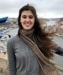
Elena Aragoneses de la Rubia
Double degree in Environmental Sciences and Geography and Territory Planning (Universidad Autónoma de Madrid - UAM), M.Sc. in Geographic Information Technologies (University of Alcalá - UAH). PhD student in the Department of Geology, Geography and Environment, University of Alcalá. FPU-Ministry. FirEUrisk project.
Telf.: +34 91 885 4482
ORCID: 0000-0003-2651-7561
Research Lines:
Mapping and parameterization of forest fuels with remote sensing and Geographic Information Systems.
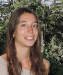
Marina Rodes Blanco
Forest Engineer (Universidad Politécnica de Madrid-UPM). MSc in Agri-environmental and Agri-Food Sciences (Universidad Autónoma de Madrid-UAM and Universidad Nacional de Educación a Distancia - UNED). PhD student in the Department of Geology, Geography and Environment (UAH).
Telf.: +34 91 885 4482
ORCID: 0000-0001-9326-5101
Research Lines:
Forest health assessment from remote sensing data, forest dynamics and structure, spatial ecology, biodiversity and conservation of tropical ecosystems.
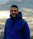
Amin Khaïroun
M.Sc. in Geoinformation and Environmental Management. Engineer in Ecology and Natural Ecosystems Management. PhD student in the Environmental Remote Sensing Research Group (UAH). Researcher in the FireCCI+ project.
Telf.: +34 91 885 4482
ORCID: 0000-0002-5757-5126
Research Lines:
Change detection, analysis of burned area and deforestation trends.
María Cristina Mihai Dragomir
B.Sc. in Environmental sciences (Autonomous University of Madrid- UAM), M.Sc. in Geographic Information Technologies (University of Alcala - UAH). FPI-MCIU doctoral fellowship. PhD student at the Geographic Information Technologies Program (UAH).
Telf.: +34 91 885 4482
Research Lines:
Near-real time forest monitoring based on active and passive sensors synergies; change detection; estimation of biophysical variables from remote sensing.
Sofía Miguel Romero
Degree in Geography (Universidad de Barcelona). M.Sc. in Tropical Biodiversity and Conservation (Universidad Internacional Menéndez Pelayo - Centro Superior de Investigaciones Científicas, UIMP- CSIC). Researcher in the FoDiM Project at UAH.
Telf.: +34 91 885 4482
Research Lines:
Forest disturbances monitoring using dense time series of Landsat satellite images, and spatio-temporal trend analysis.

Clara Ochoa Vélez
B.Sc. in Environmental Sciences (University of León), M.Sc. in Geographic Information Technologies (University of Alcala). Contract in the European Project FirEUrisk. PhD student in the Department of Geology, Geography and Environment, University of Alcala.
Telf.: +34 918854454
Research Lines:
Remote sensing of fires, machine learning, development of a model of fire occurrence due to anthropogenic factors, collaboration in the development of a fire risk management integration strategy in Europe.

Erika Cristina Solano Romero
Topographic Engineer (2015) and Specialist in Environment and Local Development (2018) from the Universidad Distrital Francisco José de Caldas (Bogotá- Colombia). M.Sc. in Geographic Information Systems and Remote Sensing (2022) from the Public University of Navarra (Spain). PhD Candidate at the Department of Geology, Geography and Environment, University of Alcalá. UAH Research Staff with ESA contract for the FireCCI+ project
Telf.: +34 91 885 4482
Research Lines:
Validation of medium resolution burned area mapping products and detection of extreme fires at global scale.
Álvaro Chávez Durán
M.Sc. in Earth Sciences with Geomatics specialization. Topography Engineer. PhD student in the Geology, Geography and Environment Department, University of Alcala. PhD student in Biosystematics Sciences, Ecology, Management of Natural and Agricultural Resources, University of Guadalajara, México.
Telf.: +34 91 885 4482
Research Lines:
Forest fire management. Forest fuel loads estimation using Geospatial Artificial Intelligence techniques.

Pegah Mohammadpour
M.Sc. in Aerospace Engineering (Amirkabir University of Technology- Tehran Polytechnic), PhD student and researcher with joint doctorate degrees from the University of Coimbra (Department of Mechanical Engineering-ADAI) and University of Alcala (Department of Geology, Geography, and the Environment- GITA).
Research Lines:
Forest vegetation mapping and fuel type mapping by fusion of satellite and drone data for fuel management and wildfire risk reduction.

María José López Caro
Degree in Tourism (UAL). Master in Geographic Information Technologies (UAH). PhD. student in Geographic Information Technologies (UAH).
ORCID: 0000-0002-6279-5801
Research Lines:
Characterization of functional diversity in forest ecosystems affected by drought decay using remote sensing.

Adrián Baissero García
Graduate in Environmental Sciences from the Universidad Autónoma de Madrid (UAM). M.Sc. in Geographic Information Technologies (UAH). PhD student at the Department of Geology, Geography and Environment (UAH)
ORCID: 0009-0004-9431-1869
Research Lines:
Estimation of forest biomass consumption and carbon release during a fire using LiDAR data and Radiative Transfer Models. Funded by a FPU-UAH/23 contract.

Emilio de Diego
Licenciate in Geography by the UCM. Master in Geographic Information Technologies by the UAH. Ph.D. student in Geographic Information Technologies at the UAH.
ORCID: 0000-0002-3612-3980
Research Lines:
Fire risk cartography and estimation, evaluation of vulnerability in Wildland Urban Interfases (WUI).
IN OTHER UNIVERSITIES OR RESEARCH CENTERS
Rubén Ramo Sánchez
PhD in Geographic Information Technologies. M.Sc. in Geographic Information Technologies. Degree in Environmental Sciences. Currently working at the spin-off company Complutig
Telf.: +34 91 885 5264
ORCID: 0000-0003-0255-3090
Research Lines:
Application of SIG and remote sensing in precision agriculture, extensive cattle industry and vegetation monitoring in real time.
Artificial intelligence, Big Data and data mining. Burned Area mapping, land cover and vegetation monitoring through remote sensing.
Marc Padilla Parellada
PhD in Geographic Information Technologies. Forestry Engineer. Currently working at the spin-off company Complutig.
Telf.: +34 91 885 5264
ORCID: 0000-0002-9432-6591
Research Lines:
Burned area mapping in real time through modelization and remote sensing, validation of burned area products, change detection, artificial intelligence and data fusion.

César Quishpe Vásquez
Post-doctoral researcher in the ConIF-Salud project. PhD. in Physics and Space Sciences from University of Granada.
Telf.: +34 91 885 5257
ORCID: 0000-0002-3598-8173
Research Lines:
Analysis of forest fires, emissions, air pollution, dispersion models and their effects on public health associated with cardiovascular diseases.

Fátima Arrogante Funes
Forest Engineer (Universidad Politécnica de Madrid), M.Sc. and Ph.D. in Geographic Information Technologies (UAH).
Telf.: +34 91 885 4482
Research Lines:
Development of remote sensing and spatial data methods for the cartography and evaluation of terrestrial ecosystem vulnerability to fires at a global scale, modelization of environmental variables using machine learning techniques.
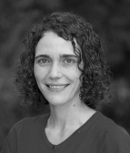
PhD in Cartography, GIS and Remote Sensing. Research Fellow, Australian National University
ORCID: 0000-0002-4049-9315
Research Lines:
Role of the vegetation in water and carbon balances. Analysis of water and carbon fluxes temporal series with ancillary vegetation and soil measurements to test and improve the AWARA eco-hydrological model at continental scale.
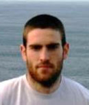
Joshua Lizundia Loiola
PhD. in Geographic Information Technologies. Degree in Geomatics Engineering and Topography. Specialist in Geoinformation Analysis, Ms.C. in Geoinformatic and Geospatial Analysis.
Telf.: +34 91 885 4482
ORCID: 0000-0002-6662-9165
Research Lines:
Burned area algorithms, global burned area mapping at global scale using remote sensing.
